
For the Reporter
Flood barriers along Pacific Park will be removed for approximately two weeks starting on Tuesday, Feb. 20, so that work crews can conduct soil investigation and install groundwater monitoring wells in support of a new flood protection project along the White River.
County crews will remove a small portion of the flood barriers to enable workers to bring drilling equipment into the park. Employees will closely monitor long-term weather and river forecasts to ensure that a partial opening of the flood barriers can be done safely. The field work will be halted and the barriers replaced immediately if weather forecasts indicate a risk of flooding. Replacing the partial opening in the flood barriers can be done in about one day. The field work would resume after the threat of flooding has passed.
The park, located on the White River in the City of Pacific, will remain closed to the public during this time to ensure public safety.
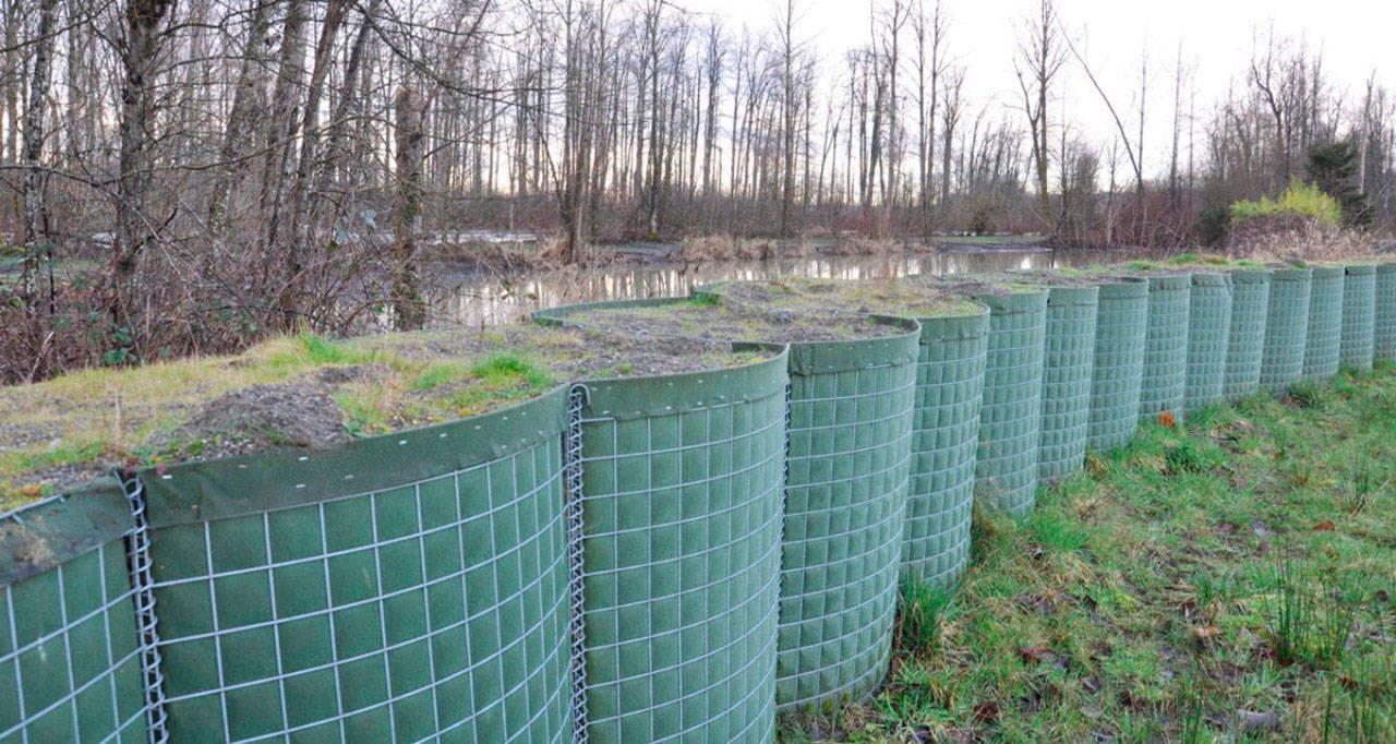
Temporary flood barriers are currently installed along the park’s perimeter to protect neighboring communities from seasonal flooding. The park is closed to public access while the flood barriers, called HESCOs, are in place.
Flood barriers have been in place at Pacific Park for the past eight flood seasons. As in years past, the park is expected to reopen this spring when the flood season is over.
The soil borings and monitoring wells will provide subsurface data for a future project called the Pacific Right Bank Flood Protection Project, which is currently undergoing an environmental review in accordance with the State Environmental Policy Act.
The King County Flood Control District is funding the project as part of its ongoing effort to reduce flood risk to residents and businesses in the City of Pacific, which faced serious flooding in 2009.
The project will be located along the right (or northwestern) bank of the White River, extending from the BNSF Railway embankment to Government Canal. The Flood Control District expects to evaluate project alternatives and select its preferred alternative in early 2019.
The right bank project is the second flood risk reduction project funded by the Flood Control District in Pacific. The first one, the Countyline Levee Setback Project, was completed in 2017. It reconnected the river to 121 acres of its historical floodplain, reducing flood risk by providing more room for the river to spread out.
The two projects are needed to address the river’s ongoing sedimentation, which has caused it to lose channel capacity over the years. The White River’s high sediment load along the Countyline stretch is due to its gradient change at Pacific and the fact that it begins on Mount Rainier, which provides the river with considerable gravel, rock and other material.
Residents can learn more about how they can prepare for flooding, including the use of sandbags to protect their property, by visiting kingcounty.gov/floodservices. More information about the Pacific Right Bank Flood Protection Project can be found at kingcounty.gov/pacific-right-bank.
