Auburn, Kent hit hardest by high temperatures, says heat mapping project
Published 4:00 pm Friday, June 25, 2021


King County released the results of a new heat mapping project showing Auburn and Kent are disproportionately affected by high temperatures.
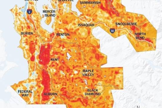
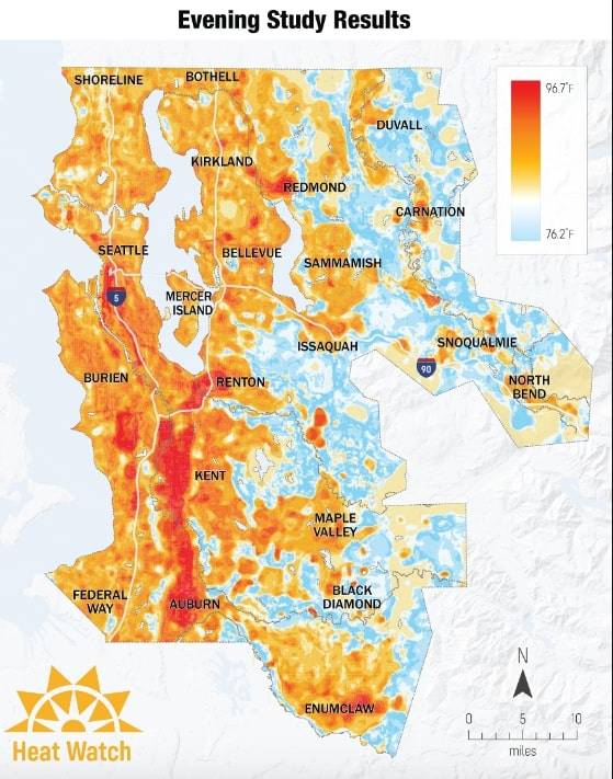
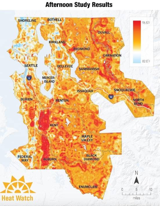
The project began on July 27, 2020, when volunteers recorded over 110,000 temperatures across King County in the morning, afternoon and evening. The goal was to examine which areas retained heat the longest.
The results show that during the day, heat is more or less evenly distributed across the county, but in the evening, more urbanized areas — specifically Auburn, Kent and portions of Seattle — hold on to the heat longer than areas with more tree canopy and natural landscapes.
Urban areas are susceptible to higher temperatures because of the abundance of hard surfaces that absorb heat such as streets, rooftops and parking garages, according to the report.
This new knowledge comes at a time when the area is expecting a record-breaking heat wave over the weekend (June 26-27) and into next week. Auburn’s forecast has a high of 108 and 112 degrees Fahrenheit on Sunday and Monday, respectively.
This could mean residents of Auburn and Kent are at an even higher risk for heat-related illnesses compared to residents in other areas across the county, according to the report.
The county plans to use the information gained from the heat mapping project to mitigate the effects of extreme heat on the areas with high heat retention.
Staying in a temperature controlled room, drinking lots of water, and avoiding strenuous work and exercise are among the best ways to stay safe during the heat wave, according to the Department of Health.
You can view the interactive heat map here.