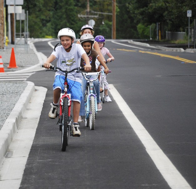
Rising gas prices, the appeal of a healthier lifestyle or simple love of the outdoors are all expected to prod many more people to consider the bicycle as an alternative to the car.
With eyes fixed on the future rushing onward like a freight train — a future in which Auburn is expected to swell to a city of more than 150,000 within 50 years — Mayor Pete Lewis formed the Bicycle Task Force last March to study bike trails and routes within the city.
Members, most of them riders or in some sort of planning role with bicycles, met 14 times with representatives of the Auburn School District, Green River Community College and the Cascade Bicycling Club.
“We started with the bike routes that are on the streets now and began working on the future,” Chair Terry Davis said Monday evening as he presented the task force’s recommendations to the City Council. “We did a lot of homework.”
The task force had three main objectives: studying bicycle connections inside the city and between cities; encouraging cycling as a healthy alternative to driving; and using Auburn’s bike routes and its fortunate positioning as a gateway to the Cascade foothills to bring potential customers to businesses.
Davis said the task force realized quickly that there are streets that don’t make sense for putting bikes and cars together, for instance, hilly 15th Street Northwest. But for those streets where bike-auto mingling does make sense, these are among the short-term recommendations of the task force. All of them are considered low-cost, high-impact solutions, though some come with higher initial start-up costs.
1. Use “sharrows” or share-the-road signage, which might include painted bicycle markings on the road in residential and some non-residential areas of the city where the streets are narrow and there is no room for additional right-of-way for bike lanes. Sharrows signage tells bicyclists where they need to be so they do not block traffic and lets drivers know where bicyclists will be, Davis said. One of the possible locations for this pilot program is the Green River Road near the Auburn Golf Course.
2. Continue installing bike lanes in parts of the city where adequate right-of-way already exists. Considered low-cost, high impact, this solution provide bicycle access on major-through streets, but space requirements can prevent other possible uses like parking or excess travel lanes. Colored lanes also have higher maintenance requirements.
3. Develop Auburn-specific bicycle signage programs to highlight north-south corridors, east-west connectors, and in-city and out-of-city connections that will help cyclists coming into the city make the smart street-to-street choices that will help them get safely to where they want to go.
4. Make improvements to the existing Interurban trail signs, pavement conditions, vegetation maintenance, grade crossings and upgrades to user facilities at the Main Street crossing.
The task force has also recommended a number of long-term, more costly improvements for which the City has no money right now to make happen. These are as follows:
1. Develop a capital program project with cost estimates for design and construction of a bicycle-pedestrian bridge at the south end of M Street, west of the existing Stuck river vehicle bridge.
2. Develop a capital program project with cost estimates for design and construction of a safe pedestrian-bicycle crossing at the intersection of M Street and Auburn Way South.
3. Install one or more bike boxes through a pilot program approach to test effectiveness and public response. Bike boxes are traffic control devices at signalized intersections that require drivers to stop a short distance before the crosswalk and allow bicyclists to stop in the area between the cars and the crosswalk. Such devices give bicyclists priority by allowing them to go to the head of the line. Possible locations include the intersection of West Main and C Street, the intersection of M Street and Auburn Way South and the intersection of Ellingson Road and A Street Southeast.
4. Install bicycle-pedestrian crossing warning systems along the Interurban trail at all crossing locations: 277th Street, 37th Street Northwest, West Main Street and 15th Street Southwest.
5. Develop an official Auburn bike map.
The task force suggested a number of follow up steps, including implementation of recommended pilot programs, development of an Auburn-specific bicycle signage program, and development of a public information education campaign. This campaign could include establishment of a dedicated City website, establishment of City Staff resources to oversee on-going bicycle education and information efforts, and development of a targeted presentation for school district churches and other service organizations.
Economically, the task force has recommended efforts to create the perception of Auburn as the “bicycle City of South King County, establishing an annual bike event in Auburn like the Redmond Criterium and Enumclaw Days, and developing an annual road race on Auburn streets.


